Thursday 18 April 2024

To Saint Martin

On Thursday 18th April we woke up to an overcast day and so cancelled snorkeling. We left at 1015 bound for St Martin, rather earlier in the month than we had planned.


In addition to Saba we also left one of the many Diamond rocks decorating the Carribbean in our wake....


As expected, the day was almost windless  and so we motored all the way.

After a completely unremarkable day, we dropped the hook in Marigot Bay, St Martin in time to watch the sunset. 

Marigot Bay is another busy anchorage - especially, I suspect, at this time of year, when like us, many yachts choose St Martin their departure point for heading north to either North America or Europe before the start of the Hurricane season in June. Benefitting from European levels of investment it's the most northerly of the Carribbean islands where 'yachties' can stock up with their favourite European delecasies and get those essential spare parts for the boat. 

We'll spend the next week or so preparing the boat for the passage to Bermuda and exploring St Martin. The island is half French and half Dutch. We are currently anchored on the French side, the north of the island. Tomorrow we'll have to check-in with the authorities. 

Saba - flatters to deceive

The friendly Harbour Master at Fort Baai (the white strip at the foot of the left hand mountain) suggested we would be more comfortable if we picked up a mooring around the corner at Ladder Baai ....

... and return to Fort Baai by dingy in the morning to check-in. For non-linguists like me, "Baai" is Dutch for "Bay"; Saba being a semi autonomous Dutch island. Quite what determines when a Dutch word is used as opposed towards English or French (both countries having previously governed the island) is a mystery. "Ladder" of course is English!

Ladder Baai takes its name from a daunting set of steps, carved in some places, that descend the near vertical cliff face that drops down onto the very narrow stretch of rocky beach. See the area to the left of the yacht in the photo below.


So we got up early and took the dinghy round to Fort Baai. It was a couple of miles around the coast but fortunately the sea was pretty calm and we came to no harm - we didn't even get splashed.

As we passed 'the ladder' I suggested we really should try the ascent before leaving the island. However when talking to the staff in the park office later, we were warned against attempting such a foolish venture. Apparently a number of yachties had recently had the same idea, only to have returned to find their dinghies had been washed away by a sudden increase in the swell lapping/pounding the beach! Of course, if I had been fully committed to the idea, I could have had Mick drop me off and pick me up. As things turned out, my enthusiasm never reached the heights required to follow up on such a fanciful notion.

Check-in was a painless affair aided by friendly staff, but in the process, I couldn't help notice the unusual number of white faces employed in these local jobs. This, it turned out, was an indication of the nature of the island. There was a white cop outside the Customs/Immigration office and a white immigration officer working inside. The Customs officer was black as was the Harbour Master whom I had to visit next (upstairs in the same building), but later in the Marine Reserve Park Office, where we had to pay a modest fee for our mooring and towards the upkeep of the reserve, we were met by 3 charming white women! In conversation with them, another hint of what we would experience, was let slip. The appropriately named town of "Windwardside" was, we were informed in encouraging terms, where most of the touristy places were. 

The hamlet and harbour of Fort Baai, is squeezed onto a narrow strip of relatively flat land at the base of an incredibly steep hill which rises UP to the first settlement of "The Bottom". Like "lambs to the slaughter" we thrust aside concerns about steepness and tourists and began our ascent to "The Bottom" on "The Road". "The Road" rises from Fort Baai and traverses much of the island, linking the port, first with "The Bottom" and then with "Windwardside". Apparently it took 20 years to build and construction began after the islanders had received expert advice from construction engineers warning them that the island's terrain was so inhospitable that it would be impossible to construct a road!

As we walked up "The Road" towards "The Bottom" it quickly became apparent that the construction engineers were quite right in their assessment - the road was quite impossibly steep. How vehicles manage to get up it, is anyone's guess and how they manage to get down without ending up in the harbour is an even greater mystery!

The ladies in the Marine Park Office told us it would take about 20 minutes to walk to The Bottom. Forty minutes after setting off we staggered into the first hostelry we came across -  the "Busy Bee" and ordered breakfast of toasted sandwiches and Lime Juice squash. I topped mine up with a Latte and a pan de chocolate. An hour or so later, our wallets, lighter by some $40 US (the island's currency - another warning sign) we set off again to walk to Windwardside. 

It was beginning to dawn on both of us that a) there was little prospect of us tackling the climb up to "The Bottom" a second time and b) we had wandered onto a very expensive island indeed. Given we were already so high up, the walk to "Windwardside" - a couple of miles off couldn't be too bad could it? So given we had got this far we may as well see some more of the island. A stroll through the rainforest hills would be just the thing. Mick had bought a good map for $5US at the Park Office, which showed a promising footpath to "Windwardside" from just outside "The Bottom".

Twenty minutes of more uphill walking later, we found the footpath and off we went into the forest. Before leaving the road we looked back over The (very neat and tidy) Bottom. 

We hadn't noticed a single scruffy building on our way through and none were evident from our vantage point either. Most unlike anywhere we had been before in the Carribbean - even Martinique! Another clue!

According to our map, The Bottom and Windwardside lie at about the same altitude. 

However, it was only after another 20 minutes of strenuous uphill walking through the rain forrest that we realised our footpath took us over a steep ridge that lay between the two settlements.

It was only the road that skirted around this ridge and was broadly level!

About a third of the way to Windwardside and still very definitely going up, we came across a wooden house by the side of the path. A white guy appeared, probably in his late 70s and waved us onwards. Nevertheless we stopped (any excuse) and chatted for a bit. He had a broad Irish accent and had apparently lived there all his life. If so he must have been descended from the original European settlers of the island which included a significant Irish contingent.

On we trekked. Another 20 minutes brought us to the top of the ridge. 10 minutes later still in the thick rainforest we heard what sounded like a leaf blower or lawnmower! In another 10 minutes we were outside a small boutique hotel lodge still surrounded by rainforest. We looked at each other - "cold beer"!?

The place looked deserted but clearly someone was there. We walked up the path and found the chap making a noise, Eddy from Colombia. He was looking after the place. It was closed today, but, yes of course we could have a beer. Saved!

After our break we continued on. Another 15 minutes and we were on the road, another 5 and we were in Windwardside. The appalling truth was laid out in all its awful glory. In the middle of this beautiful mountainous island we had stumbled into what to me seemed like a tasteless cross between a film set and a Disney village. "Twee" didn't come close. Suddenly there were tourists milling around gift shop after gift shop and restaurant after restaurant. Inexplicably, the island's main Dive centre was also here. We had a quick look around - I really didn't think I could stomach more - and then repaired to the cheapest looking restaurant we could find for an early (1230) lunch. The cheapest thing on the menu was hotdog and fries for $12US, but no, they didn't have any. A bacon burger for me ($17 US + fries $3) and a chicken sandwich ($15) for Mick. Beer, at least, was more reasonable, 'only' $3-3.50 a small bottle. With tax, lunch came to $40.25US.

We walked back to The Bottom and I at least, was thoroughly disillusioned with the island. At first sight it promised so much. Neither of us could see any reason for making a further ascent up the hill from the harbour and so agreed we would leave the next day, perhaps after snorkeling. After a beer in one of the Bottom's bars we descended to the harbour and were just in time to check-out for the next day.

Wednesday 17 April 2024

"Hello", "good-bye"; Squalls, Montserrat abandoned, onwards to Saba.

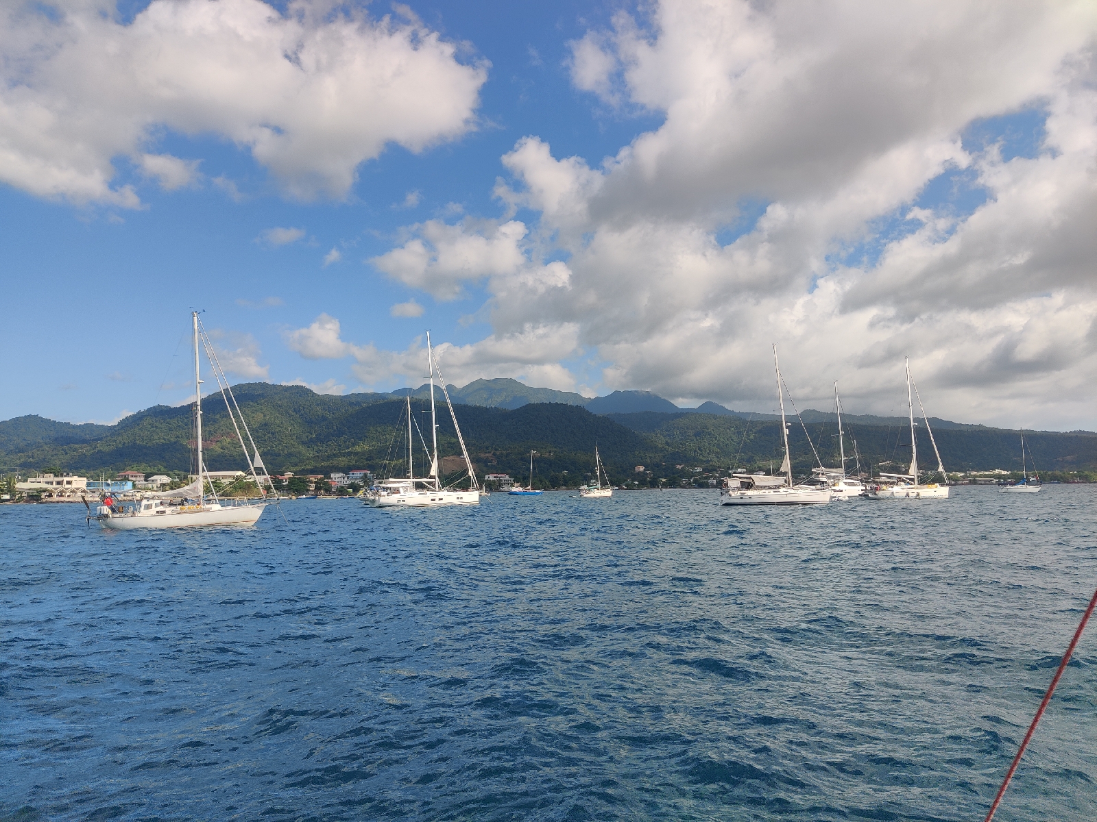
When we arrived in Portsmouth, St Rupert's Bay, Dominica on Friday 5th April, Lasse and Birgitte on Aura were already there. Titti4 with Jan and Elli on board, arrived on the evening of Wednesday 10th and Johannes and Olena on Laura, arrived on Thursday 11th.

Aura left on Saturday 13th.

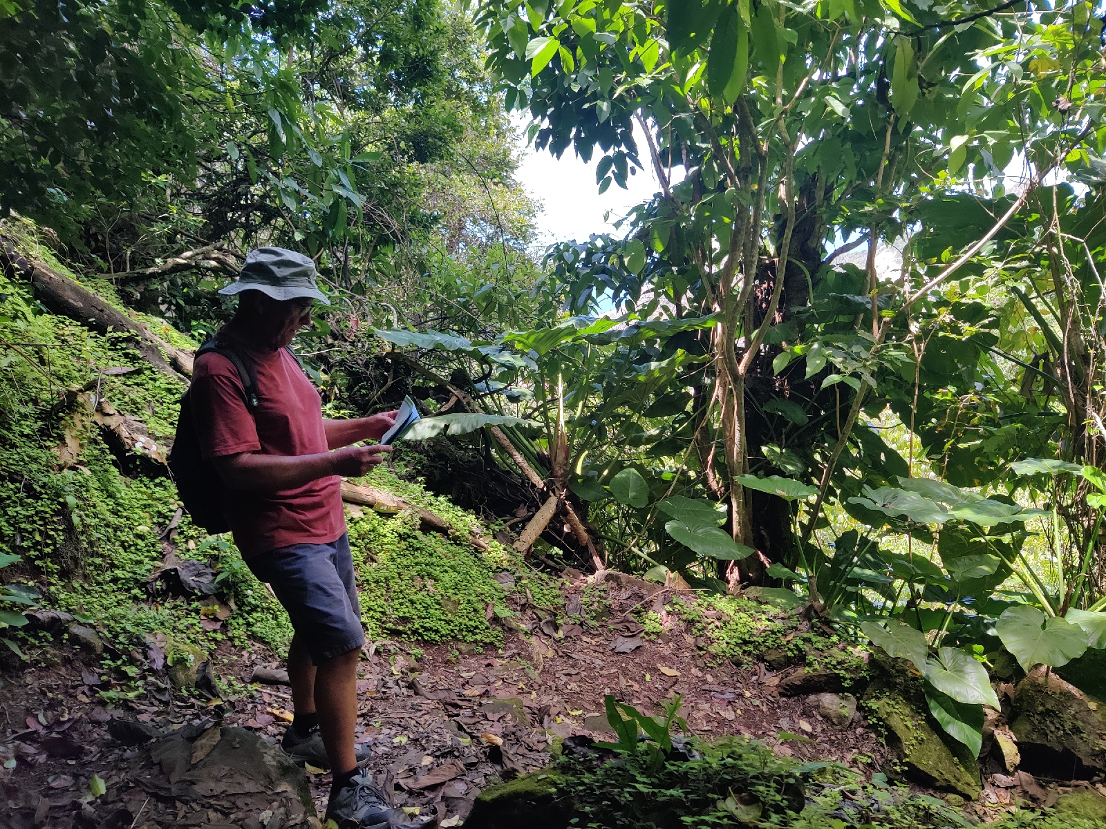
On Sunday 14th April, Bonny departed. Titti4 was due to leave  the next day but  Laura would be staying a few more days to explore the island some more. 

All these comings and goings were marked with a flurry of "hello" and "goodbye" gatherings. We kicked things off by hosting Lasse and Birgitte for dinner on the evening of our arrival. Mick cooked his 'famous' Spaghetti Bolognese. 

On Sunday 7th the crews of Bonny and Aura attended the local beach barbecue with the rum punch getting the better of some! On Wednesday 10th, having recovered sufficiently from the excesses of Sunday, Aura hosted the first goodbye party, for the crews of Bonny and Titti4.

The next day, Thursday, was Elli's birthday and I awoke to find Titt4 'dressed overall' to mark the occasion and very smart she looked too. Jan and Elli therefore had a further excuse to host yet another party for us all, including Johannes, Laura having arrived earlier that evening. Unfortunately, Olena was poorly and unable to join us. 

The next day, Friday, Mick and I hosted the final goodbye party on board Bonny...

On Sunday morning the 14th April, we said goodbye to Jan and Elli and then went for coffee on board Laura with Johannes and Olena (who happily, was now restored). After lingering too long over coffee, we said our goodbyes, returned to Bonny and prepared to leave and eventually weighed anchor at around 1230, leaving the remaining half of our impromptu fleet, Laura and Titti4 behind in the bay.

Will we see any of them again? We had made great friends with everyone and it was sad to say goodbye in the knowledge, that with the exception of Jan and Elli, we probably won't - at least not in the next few years. 

Lasse and Birgitte are bound eventually, for Trinidad in a couple of weeks, where they will leave Aura for the Hurricane season and return home to Sweden for the summer. They will return to Aura in the Autumn to continue their wanderings and may well circumnavigate.

Johannas and Olena are also still in the relatively early stages of a round the world odyssey.

Bonny is of course heading north, with this summer's destination being Nova Scotia, where I hope to leave her for the Autumn/Winter and return home by air before continuing the journey after a family holiday there early next summer.

We do expect to see Jan and Elli again fairly soon however, because they too are bound for Nova Scotia. They will probably catch up with us in Saint Martin from where we both intend to depart for Bermuda before heading for truly northern waters.

We left Dominica with the intention of sailing to Montserrat. We had a beautiful sail across the gap between Dominica and Guadalupe with a few spells of motoring during the night when the hills of Guadalupe stole our wind. Conditions freshened as expected after leaving Guadalupe behind and we had a cracking sail to Montserrat, arriving off the south east of the island before dawn on Monday.

It was quite an eery experience. We saw the dark shape of the island emerge whilst it was still dark, but there wasn't a single light to be seen. The southern half of the island is still a no-go area following the volcano eruption in 2011. As we sailed up the east coast, lights emerged and then dawn broke - very quickly,  but so too, did the weather. Suddenly we were being lashed by a violent squall of 30+ knots, and driving rain. One minute I was at the mast in the blackness of night, struggling to reef in the midst of the squall, the next, dawn had arrived. Admittedly, it was a  dawn more reminiscent of the Thames Estuary than the Carribbean. Slate grey with squalls now plainly visible all around. With two reefs now in both main and genoa we continued on our way, anticipating a dry-out, a rest and a hearty meal at the anchorage on the north west of the island just a couple of hours away.

Oh foolish boy! As we approached the anchorage with just two yachts in attendance and rolling heavily, it was clear that a heavy swell was making its way in and would make for a most uncomfortable stay. 

Neither of us fancied that prospect so we turned round and headed... It took some considerable time to decide where. The conditions seemed to abate as we drew away from the island, convincing me that it was the island creating the squalls as it rudely disrupted the flow of the trades. The sea was of course still up, a nasty combination especially with the wind free. There's not enough wind to stop the main boom crashing about as the boat rolls. So we shook out the reefs and rigged a preventer on the boom. No sooner had we completed that than another more violent squall struck. For a few minutes we were screaming along to windward on our ear under a full genoa, as I once again put two reefs in the main. Then we reefed the genoa (I should have reefed it first) and sanity was (sort of) restored.

Where to go? Given the conditions we met at Montserrat, a sheltered anchorage was a priority. The nearest was Antigua about 20 miles away, but that would be a dead beat up-wind in pretty gruesome conditions. The anchorages on the south of St Kitts seemed to offer a reasonable alternative. They were fourty miles away, but we'd have the wind off our quarter and should get there in eight hours or so.

With the wind from the quarter or further aft, the mainsail blankets the genoa, causing lots of crashing about as the sheets slacken and tighten in response to the rolling of the boat. So we doused the mainsail and continued under deeply reefed genoa - still making 6+ knots!

The foul weather continued for most of the day. As we approached Nevis, the visibility took a dive and for a while was very poor. It really did feel like home. However, the wind eased as we gained the lee of the islands and so I shook out the reefs in the genoa.

After an hour or so groping our way down the south coast of Nevis in the murk, the visibility improved and we could see our destination, White House Bay, to the south of Basseterre, a few miles off. 

A great deal of faffing about, then followed. We didn't plan to go ashore. Having visited the island before in 2017 we wanted to spend our remaining time in the Carribbean visiting islands we had not seen before.  However, St Kitts' Customs authorities have a reputation for being rather fussy and overzealous and so when I read the note on my Navionics chart for our preferred anchorage - with its dire warning of hefty fines being issued to boats that anchor anywhere other than the Port of Entry Anchorage before checking in - I got cold feet and we headed over to the official anchorage. This took an hour of motoring. We arrived to find a swell running which was almost as bad as that we encountered at Montserrat. "Bugger it, we'll risk the fine" I thought and so we headed back towards White House Bay.

Two hours later, around 1600 we finally dropped the hook next to a very smart, purposeful looking vessel flying the OCC house flag. This was notable on two fronts. Firstly, it was pristine and put our very tatty specimen to shame...

Secondly, hardly any OCC members fly a house flag, they nearly all fly a burgee (triangular), not from the mast head which is the proper place for a burgee, but from the spreaders, which is most definitely not the proper place. 

Then I noticed fluttering from her mast head, a burgee, that of the Royal Cruising Club. That explained it. The RCC is a most august organisation. Established in around 100 years ago it has amongst its ranks many famous yachts people who have undertaken demanding voyages in the most challenging parts of the world from the Arctic to Antarctica and some have even visited both regions on the same cruise. 

Perhaps the most famous of RCC members was one William (Bill) Tillman, who in the 1960s/70s led a series of sailing and climbing expeditions on his venerable Pilot Cutter, "Mischief", to the Arctic, Argentina and the islands of the Southern Ocean. Bill survived two shipwrecks in the Arctic. The first when his beloved "Mischief" was lost after arguing with the ice and the second when her replacement, another Pilot Cutter, was lost only a couple of years later in similar circumstances. Bill was eventually also lost at sea in his twilight years, leading one last expedition to the Southern Ocean; an end which whilst tragic, seemed only fitting. 

But back to the present. When a skipper is a member of more than one sailing club, etiquette requires they fly the burgee of the oldest club at the mast head, above all other flags. Our neighbour therefore clearly knew his flags! 

Why belong to two clubs though? Well, the RCC is, in sailing terms, a somewhat rarified organisation, with a fairly small, by invitation only, membership. As a consequence, there just aren't many of them to fratanise with. So, if you like making new friends as you wander around the oceans, you need to be part of a bigger community. 

With a membership of 1000+ and growing the OCC fits the bill perfectly. This year, it celebrates its 70th birthday and so there are even more excuses to party than normal. To be a full member you need to have completed a non-stop qualifying passage of at least 1000 miles on a sailing boat of no more than 60 feet long; so you've got to be pretty keen. 

Mick and I qualified in 2016 on our crossing from Cape Verde to Martinique. When established, 70 years ago, in the days of small wooden boats (a 30 foot boat was big in those days) and sextants and paper charts, an Ocean passage of 1000 miles, really was a major achievement. With GPS, chart plotters, watermakers and increasingly, onboard internet and of course, far bigger boats, today's members have a rather easier life.

The enthusiastic waves from our new neighbour's crew, were rather more than a polite greeting - we must have met before. Even without our disgraceful OCC house flag, we had clearly been recognised. I couldn't see a boat name and so checked our AIS. It was "Henry". I had last seen her and her youthful skipper, Will, in Pasito Blanco.

Within half an hour, Will came over in his dinghy with his pal Pete, to invite is on board Henry for drinks. How could we refuse? Henry was custom built in Poland from aluminium to a Van Der Statt design and fitted out in Falmouth by Will and his parents. On board we also met Dessa, Pete's partner. We enjoyed a very pleasant evening, being plied with drinks and catching up on each others travel stories. 

I couldn't come close to Will's however and it soon became apparent why the RCC burgee flew from Henry's mast head. Will's day job is as Skipper on the British Antarctic Survey's, "Sir David Attenborough" and he had only recently returned from a trip to the bottom of the world. He had therefore missed out on the Atlantic crossing on Henry, which his parents had undertaken without him. 

Henry was heading for Newport where Will will park her up before re-joining the Sir David Attenborough in June for another venture to the Antartic! 

Mick and I needed a lift back to Bonny and so we all piled into Henry's dinghy and carried on the session back on Bonny. Afterwards I was just able to stay awake for long enough to cook and eat dinner!

We needed an early start in the morning to be assured of making our next stop in daylight. So I dragged myself out of bed in response to the alarm st 0500 and we were underway by 0630.

A delightful sail to Saba, 40 miles to the north west, followed and after speaking to the helpful and friendly Harbour Master at Fort Baai (the only port of entry) over the VHF, we carried on to Ladder Baai on the south west coast, where we were assured, we would have a more comfortable night.

We were to check-in at 0800 the following morning.

Sunday 7 April 2024

To Dominica

Yachts at anchor in Prince Rupert Bay with the town of Portsmouth in the background

We had visited Dominica before in January/February of2017 (and Martinique too) when we judged it our favourite Carribbean island and were therefore looking forward to our return visit. In September of that year Hurricane Maria year hit the island causing widespread destuction to life, property and environment, including damage to 90% of the country's housing stock. How had the island fared since, I wondered?

We spent Easter Monday recovering from the excertions of our little walk and on Tuesday tackled our jobs list, provisioned the boat and checked out.

Mick spent most of the day contriving a fix to the water pump, which, despite his best efforts, failed again the following morning. The purchase of a new pump was therefore added to our final pre-departure duties to undertake on the Wednesday. Filling our emergency water containers (2 x 20 litres) and collecting previously ordered medicines from the pharmacy and stowing the dinghy on the foredeck, being the other main tasks

We finally, weighed anchor at 1445 and motored out of the anchorage. 

A fresh east by north east wind was forecast and so once in the obstacle free water of the outer bay we put one reef in the mainsail and made sail. Our route was to be up the west coast of Martinique, across the gap of about 20 miles between the two islands and then up the west coast of Dominica to Portsmouth near the northern extremity of Dominica.

The only navigational challenge of the passage was finding the optimum balance between maintaining a course as far east as possible to allow for the west setting winds and currents, whilst staying sufficiently far off shore to avoid the 'worst' effects of the wind shadow that the high ground on both islands would inevitably create.

I didn't get it quite right because we were reduced to motoring on a few of occasions for periods of 30 minutes to an hour when in the lee of hills on both islands. 

As expected we experienced the strongest winds when in the gap between the islands. Unfortunately this coincided with Mick's period off watch. He wasn't quite quick enough closing the fore hatch, and so his bed got a good soaking; (the hatch isn't completely water tight in heavy weather even when closed).  

He therefore decided to relocate his bed. Regrettably, the most obvious candidate for a new bed, the pilot berth, was unavailable, being full of clutter, due to me having ceased to use it as a berth, because in the tropics, being high up, it just got too hot. 

Therefore, on one of my trips below decks I found him on the forward bench seat (these run across the boat either side of the table) which, when on the starboard tack, are on the leeward side of the boat, with his head on the higher end of the seat, his trunk (sort of) lying on the seat and his legs and feet propped upwards on the pilot berth. Quite how anyone could be asleep in such a position I couldn't imagine, but he appeared to be!...

Reconstruction!

For the most part we had an enjoyable early morning sail up the Dominican coast interrupted only by a couple of spells of motoring.

After a passage of about 18 hours we dropped anchor off Portsmouth in Prince Rupert's Bay at 1030 on the 4th April.

Our Swedish friends Birgitte and Lasse on board Aura had arrived a couple of days before and we invited them aboard for dinner that evening. Before then I dropped Mick off at the town quay to shop and I went off to check in with the authorities.

Our friends arrived at 1800 in time for us all - armed with G&T - to watch the sun go down...

Mick produced one of his excellent signature dishes - spaghetti Bolognese!

Like us, Birgitte and Lasse had both been to Dominica before (on separate occasions). Birgitte had made good friends with locals back in 1987 and was on a mission to try and track down the family and the next day they were heading into the mountains to look for them.

We agreed to team up the day after to take a tour up the Indian River, something we had all done on previous visits to the island. 

Thus far, it seemed to my casual observations, that the island had recovered well from the devestation caused by Hurricane Maria. I was to find out more on our trip up the Indian River!


Saturday 6 April 2024

A walk on the wild side

Bonny returned to Le Marin on Saturday 29th March. We had some maintenance jobs to attend to - the water pump had failed again; the outboard motor needed an oil change; the stern gland needed checking as did the engine anode. All these jobs would be easier to do in the flat and sheltered waters of the anchorage there. 

Aura and Lea had decided to explore the east coast of the island behind the reefs, but in addition to the above jobs list, I was slightly worried about the possibility of geeting 'trapped' behind the reefs with the return of the prevailing easterly wind. We also needed to do some more provisioning and Mick needed to get some prescription medication. So back to Le Marin it was.

We had a great sail back including tracking up the slightly contorted approach to the Le Marin anchorage. It provided an opportunity for the mate to get a good workout manning the Genoa sheets!....

The following day was Easter Sunday and so we deferred our day of labour in favour of taking a gentle country stroll across the island's southern Penninsula to Bais de Anglais, which of course, we had only just sailed from! Superficially, a somewhat peverse decision, but the wind on Saturday had been ideal for the sail to Le Marin whereas it was not on the Sunday and this way we would see more of the island.

So, in keeping with the finest traditions of eccentric English lore, we set forth like the proverbial 'mad dogs and Englishmen' at around 1100 for our hyke across the island. We had the foresight to take food and a little water and were confident in our expectations of finding refreshment stops along the way.

Unfortunately our pre-departure planning had been a little rushed - our route was actually rather longer than I had judged and rather more of it was on roads than I had realised and the road for the most part was busy with Sunday traffic and was devoid of a footpath, or as one notice we passed, quaintly put it, "Absence de accotment" "Absence of the shoulder". Where we wondered, had the shoulder gone?

However, we were comforted in the certain knowledge that it would therefore not be long before we came across a bar where we could refresh ourselves with a cold beer. After a couple of miles we came across a service station but passed it without stopping in the expectation of finding more decorative surroundings for consuming our much anticipated draft.

Another mile passed and we were now in the hottest part of a hot day and firmly of the opinion that surroundings no longer figured; we just needed a cold beer. Then, a few hundred metres ahead at a roundabout, a mobile roadside café hove into view. It became clear that all sorts of delicacies were available; from beer, to home made fruit juices and smoothies, to ice cream. I was pretty sure I could manage all three, but we decided to start with the beer. Our hostess was extremely talkative and friendly and the two bottles of beer stood there unopened on the counter for a good 5 minutes while she talked nineteen to the dozen only pausing momentarily when it became clear to even her, that we understood very little of what she was saying. Although, to be fair to Mick, he understood rather more than me.

Finally, she reached for the bottle opener... "Stop" said Mick. Her hand froze above the bottle. Mick looked at me. "Have you got any Euros"? The penny dropped! "No" I croaked. "I think I may have five" he said. Our hostess looked on puzzled - not surprisingly! Once our predicament had been explained she confirmed she didn't take cards! "I bet that bloody service station did" I thought. "Combien coûte la bière ?" Mick asked. "€4" came the reply!

So we shared a small bottle of beer and continued, a little crestfallen, on our way. "How could we be so stupid"?

To rub salt into our wounds, the footpath shown by google was fenced off and we had to continue another mile on the busy road with its absent shoulder. Then I misread the map and took a wrong turn up a footpath up a steep hill and only after 20 minutes of hard climbing did Mick spot my error.

Eventually we found the right path and were able to enjoy a pleasant walk through some woods and eventually at about 1400 we emerged on a ridge overlooking a crop of what looked young Maise above the Bais de Anglais....
There we had our lunch and nursed, what was by now very clear to us, a very inadequate provision of water.

After 30 minutes with time pressing on, we decided against descending into Bais de Anglais and continued on our way across the peninsula to a beach on the southern coast. It was well worth the walk...
We immediately donned swim ware and cooled off in the Atlantic Ocean.

Aftewards we continued southwards down the beach and then into a most strange desert like terrain of shingle with cacti of various types scattered across it, which then gradually morphed into scrubby mud/salt flats 
This took a good hour to cross - sometimes the mud became so soft that we had to retrace our steps. Eventually however we emerged onto another beach lined with trees. Soon we came across tents and camper vans in the shade of the trees. We had stumbled across a campsite that seemed for miles along the beach. It seemed that thousands of locals were out on an Easter camp. We found an outside shower fixture and stuck our heads under the shower water to cool down. I even drank a little - fortunately to no ill effect. We also filled our now empty water bottles just in case.

A check of our route showed we still had 3 or so miles to go to the town of Saint Anne where we hoped we could get drinks, cash and order a taxi to take us the final 5 or so miles back to Le Marin.

On we trudged. By now it was around 1600 and we were both done in. We finally reached St Anne around 1700 (Google Maps' "mostly flat" annotation was way off the mark for the duration of the hyke).

We found just about the only shop open and bought beers, water and a variety of soft drinks before collapsing on a bench in the town square overlooking the bay to guzzle the lot.

Then we found a cashpoint and wonder of wonders, Mick managed to order a taxi over the phone. I don't think either of us would have made it back on foot!

We were back on the boat by around 1900 - thoroughly knackered. That night we slept as soundly as I have ever done!