Monday 29 July 2024

Isle aux Morts (Isle of the Dead)

It's a bit of a grissly name isn't it! There is of course a reason for that, but I'll come back to it later.

The Isle aux Morts lies very near the western-most extremity of New Foundland's south coast. I headed there on the first leg of my return journey to St Peter's on the Bras D'or Lake, Cape Breton. The hope was to get a better angle from the prevailing south westerly winds, for the passage across the Laurentian Channel seperating Cape Breton from New Foundland. It also meant I would get to experience a somewhat less dramatic, but as I was to discover, no less treacherous, coast. My discovery was historical rather than experiential, I hasten to add.

The 120 mile or so passage took 24 hours almost to the minute. The forecast was for mainly light headwinds and so I was fully resigned to motoring all the way. As it turned out though, I managed to sail on and off, for perhaps half of the time, which was a bonus. 

The first part of the night was the most tiresome, with no wind and thick fog. The noise of the engine made it difficult to hear the alarm from the radar monitor, which meant snatching even a few minutes 'sleep' every 15 minutes or so, all but impossible. In the event I encountered no other vessels overnight but it would have been nerve wracking in the extreme to have been in that fog without radar.

Things improved later with the arrival of a few hours of a sailing breeze and the lifting of the fog.

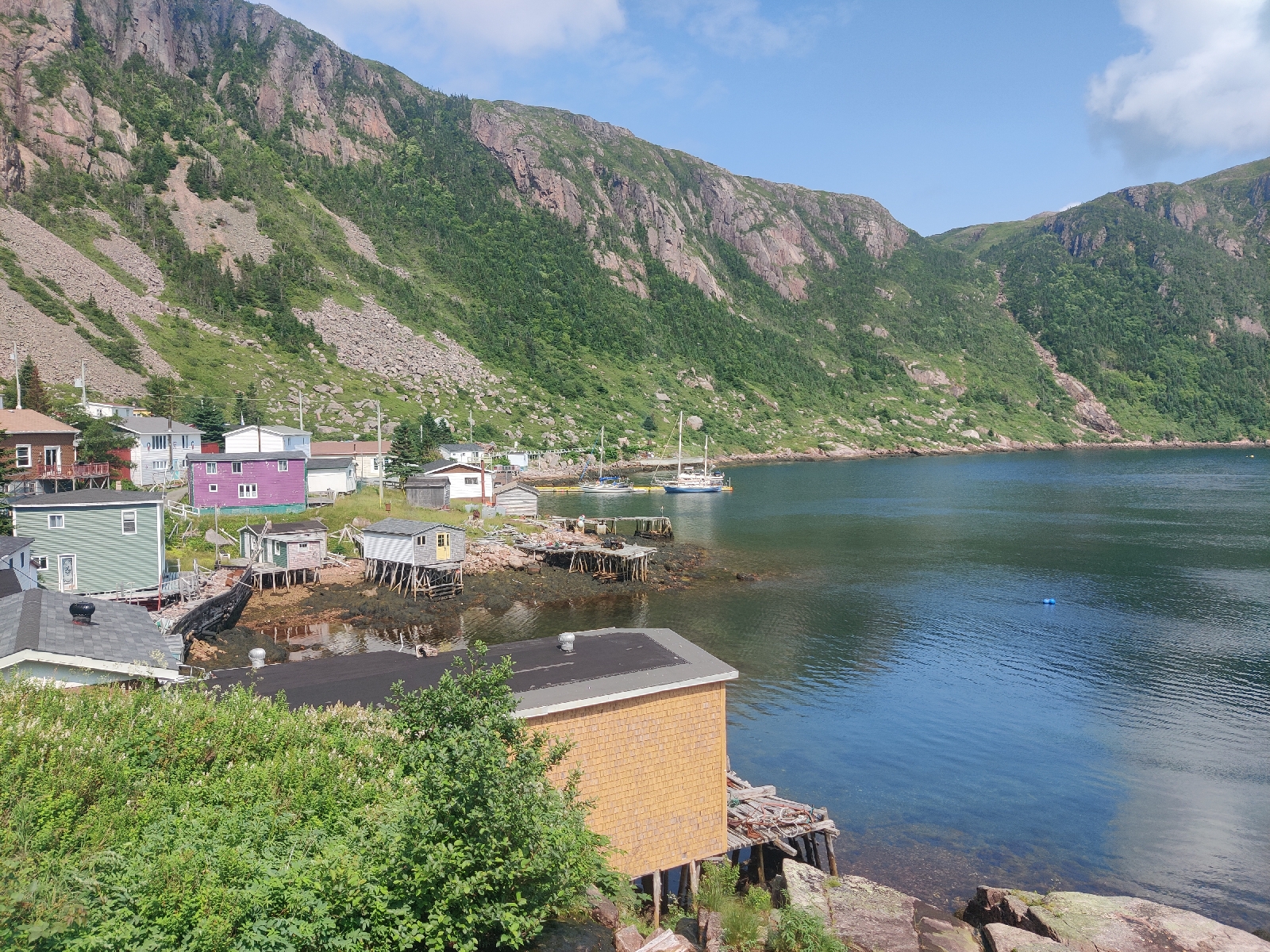
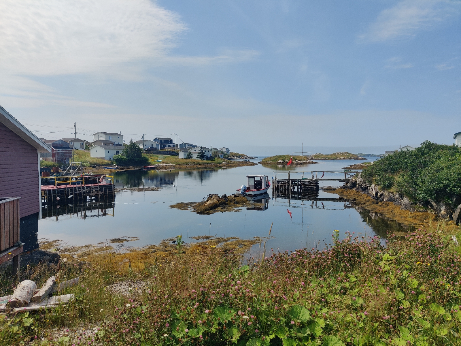
On arrival at Isle aux Morts, I moored alongside the town quay; around which there was a lot of activity. It turned out I had arrived in the middle of their "Harvey Festival", held every year at the end of July to celebrate the life and heriocs of one of the earliest settlers in the area. George Harvey arrived from Jersey in 1780 and subsequently, along with his daughter Jill and their dog, affected two major maritime rescues of the crews and passengers of  sailing ships wrecked on this treacherous coast. 

A very friendly local helped me moor up.

My guide book said their were two shops in Isle aux Morts but they had both closed down!

I was therefore extremely grateful when Rolly (the friendly local) later drove me into the nearest major town (Port aux Basque) about 10 miles further west, to get some cash, do a bit of shopping and fill my reserve diesel jugs. 

That night I went along to the open air music event held as part of the festival and met up with Rolly (and his wife) once again. I was hoping the music would be local folk but it was loud rock. The band was actually pretty good, but these days I find it almost impossible to converse amongst such a din. I spent a couple of hours there and went back to the boat for midnight. I was pretty knackered anyway, having got little sleep the previous night.

The next morning (Sunday 28/7), before the wind got up, I moved the boat off the quay to a nearby anchorage with the delightful name of "Mickle Tickle" - a narrow stretch of water between "Mickle Island" and the mainland.

After a late breakfast I rowed ashore to walk the "Harvey Trail", established by the locals to remember and celebrate the life of the Harvey family.

The trail started somewhere at the other end of the town which, back in the hay day of the Cod Fisheries, was a major settlement boasting a large fishing fleet and fish processing plant and thousands of residents. Today, the fish processing plant is a crumbling ruin and only a few hundred people live here permanently and all the shops have closed.

I had a little difficulty finding the start of the trail, but once again Rolly came to my rescue. Driving past, he stopped and took me to the trail head. A friendly and most helpful chap.

Before beginning the trail I took a look around the cemetery just next to the start.

I wondered whether there were any "Bagg's" or "Baggs'" there. Sure enough, there was one..

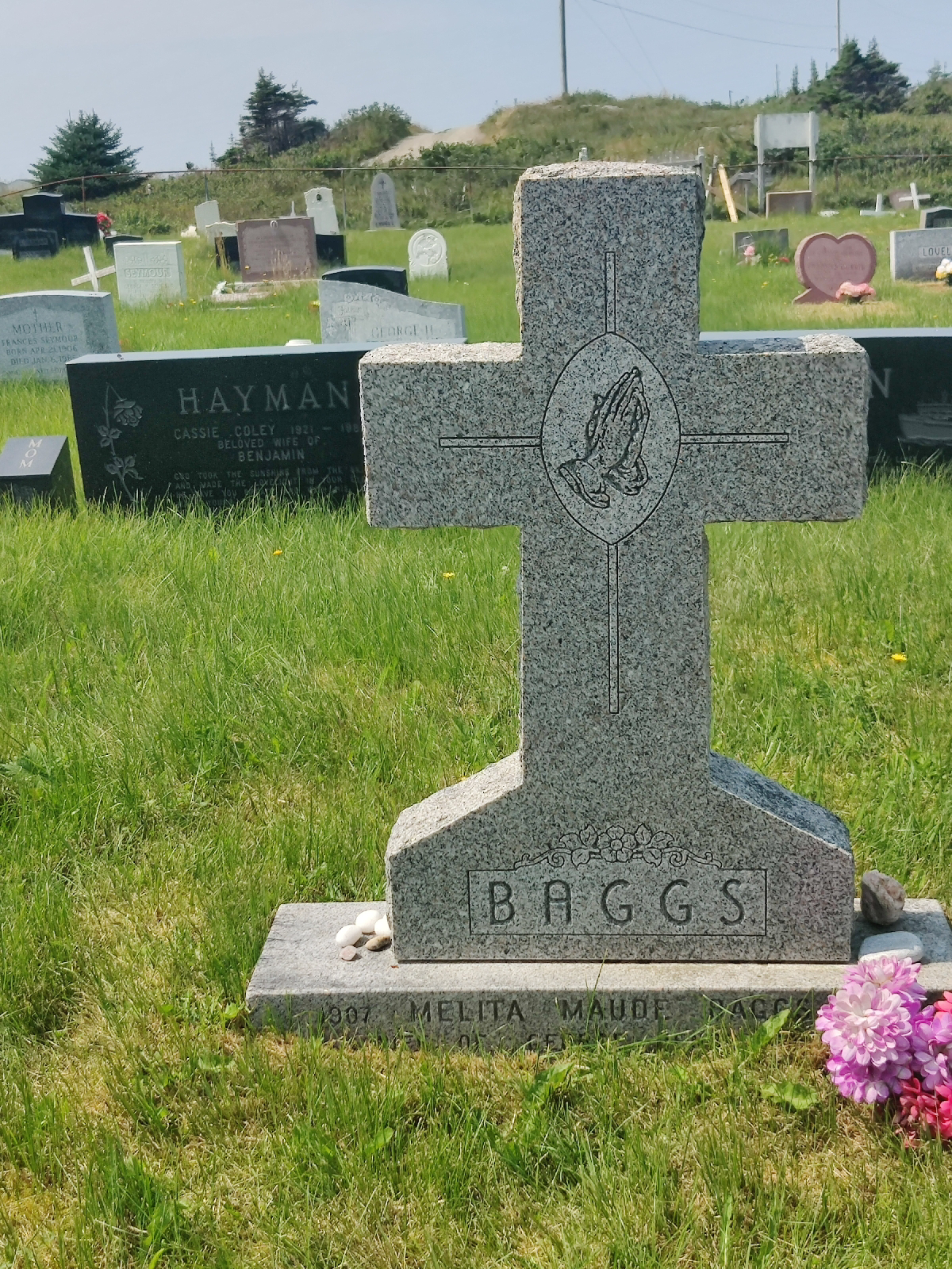
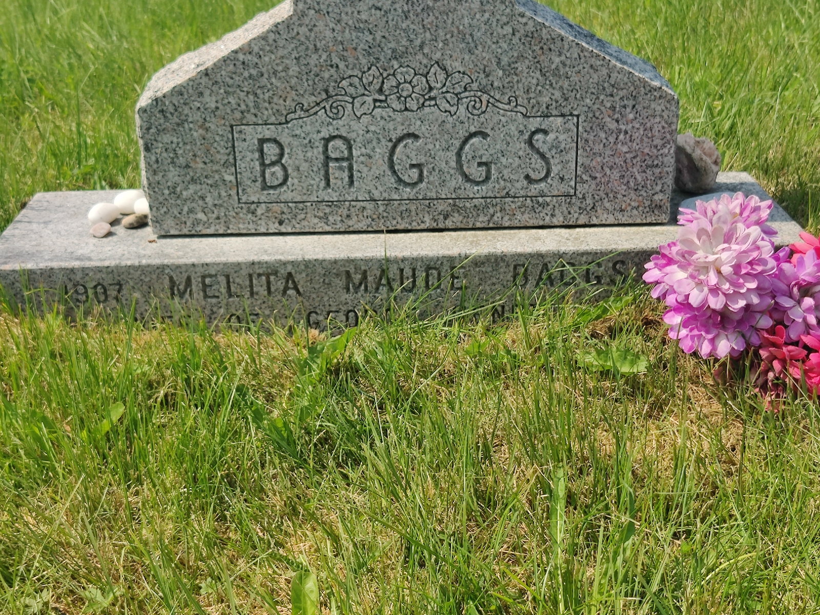
Maybe one day, I'll try and find out more about them.

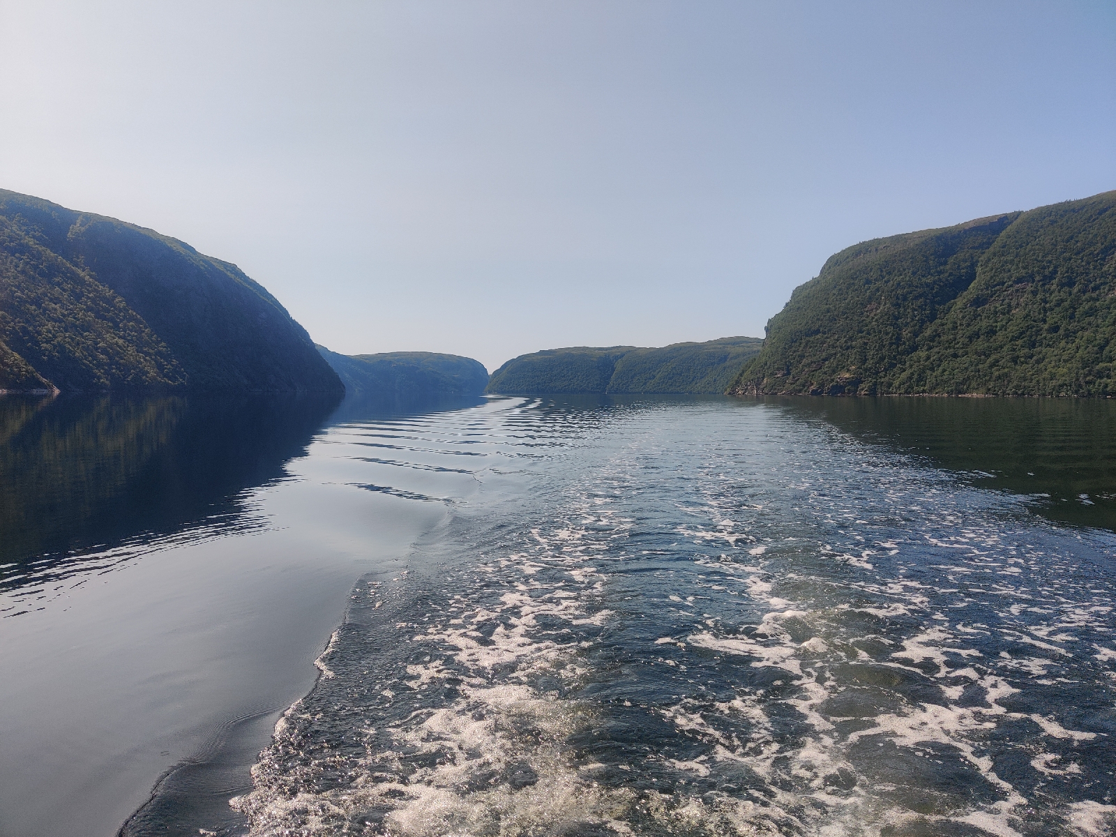
The trail wound it's way along the coast...

...but every so often, sections of the land it was on, had fallen into the sea...

...victims of the remnants of Hurricane Fiona that ravaged this coast in 2022!

Later on the trail I stopped and chatted to a local who was repairing it.

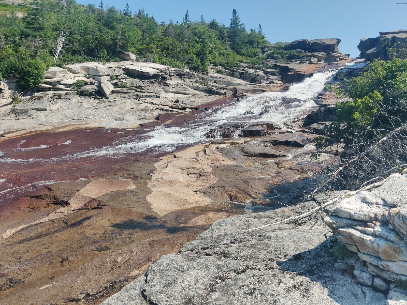
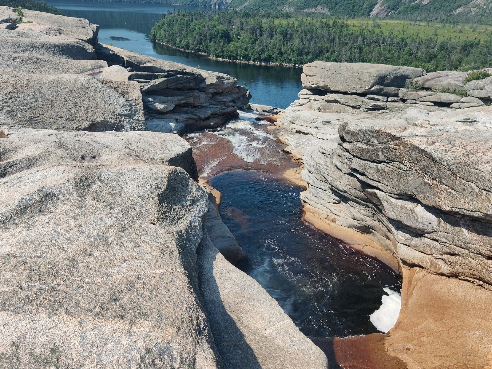
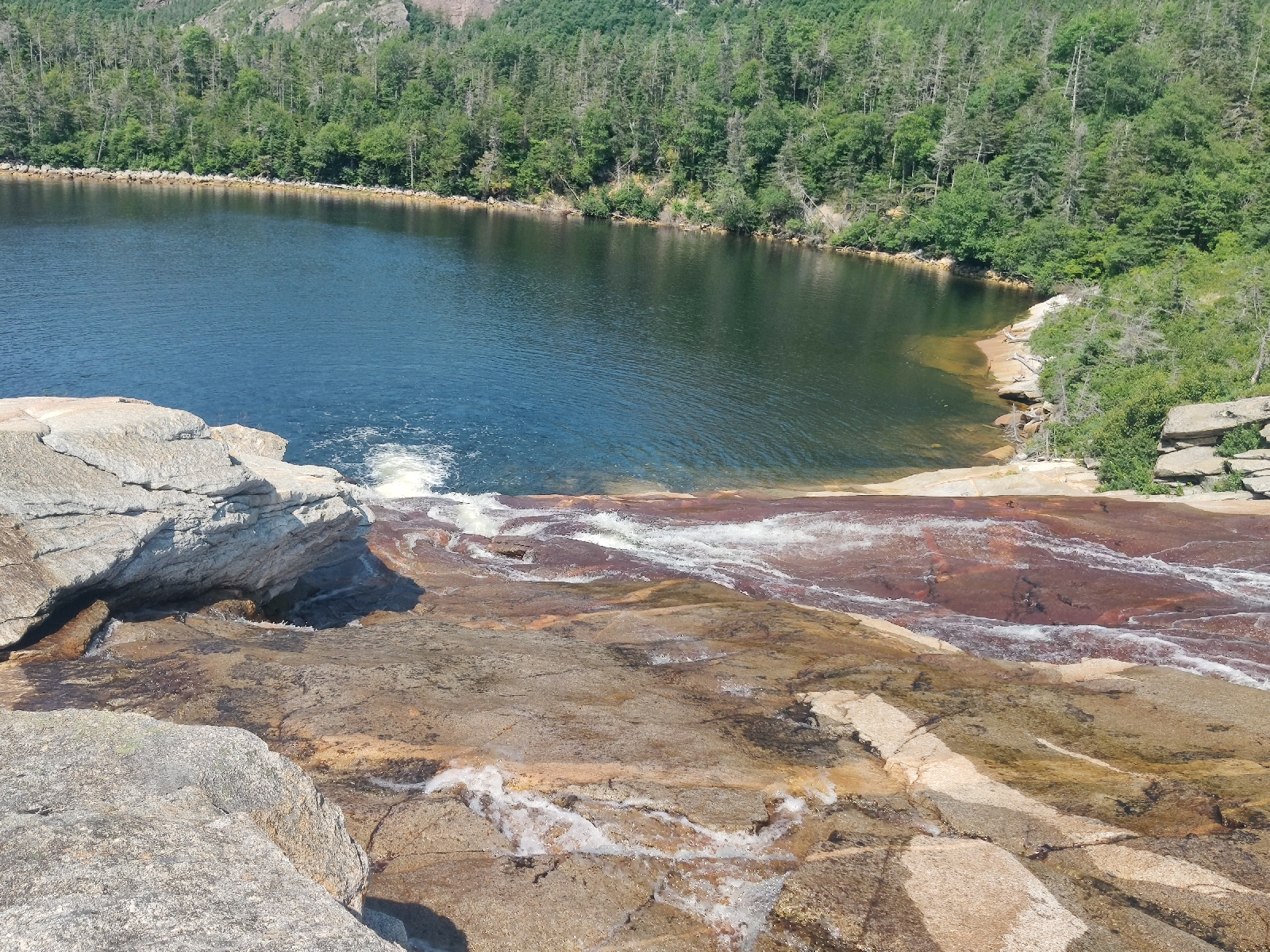
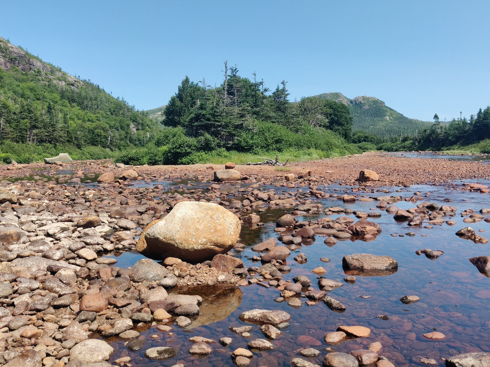
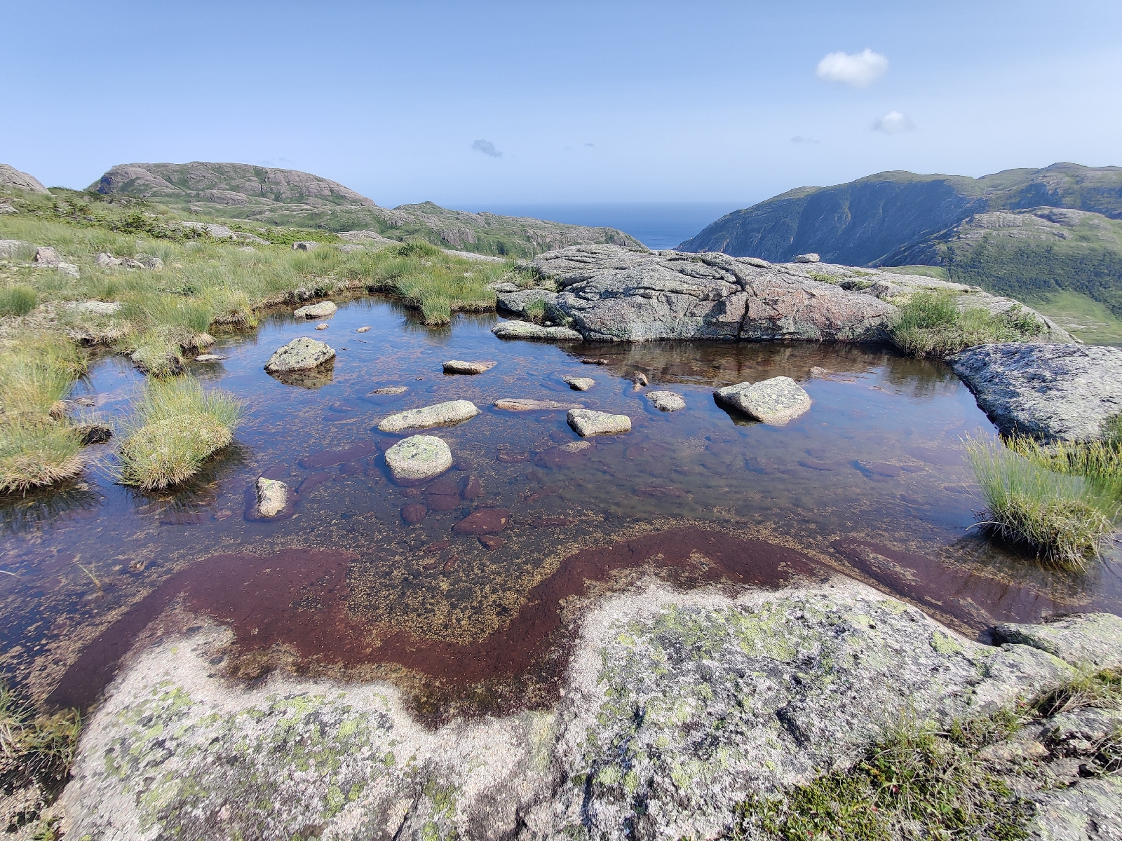
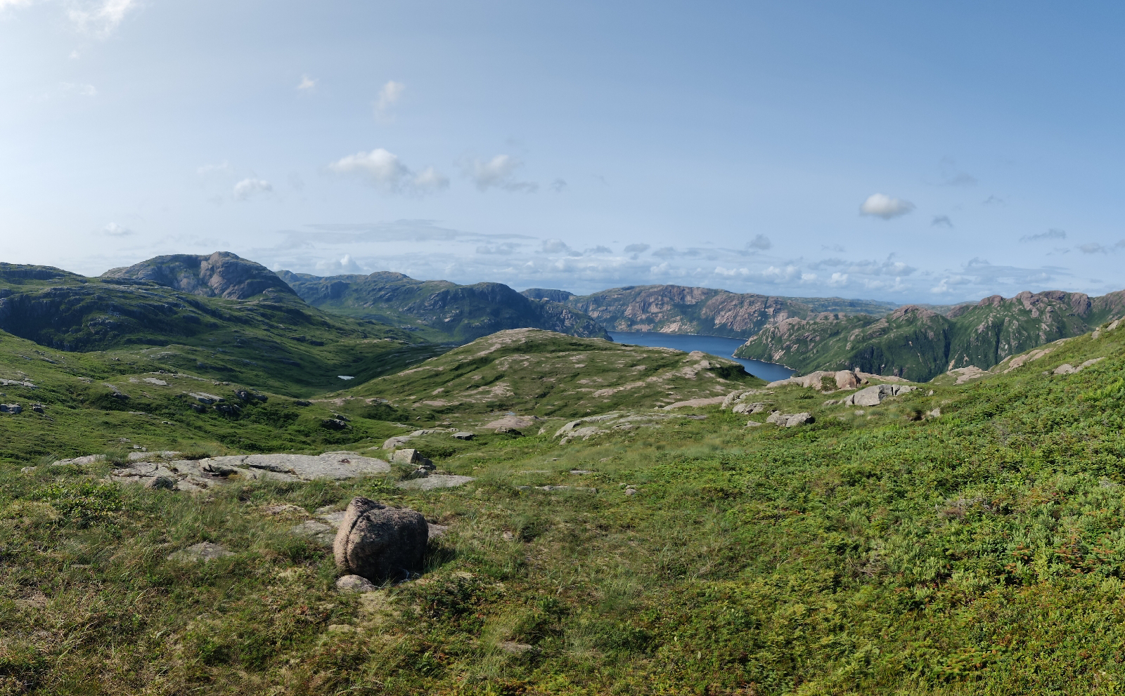
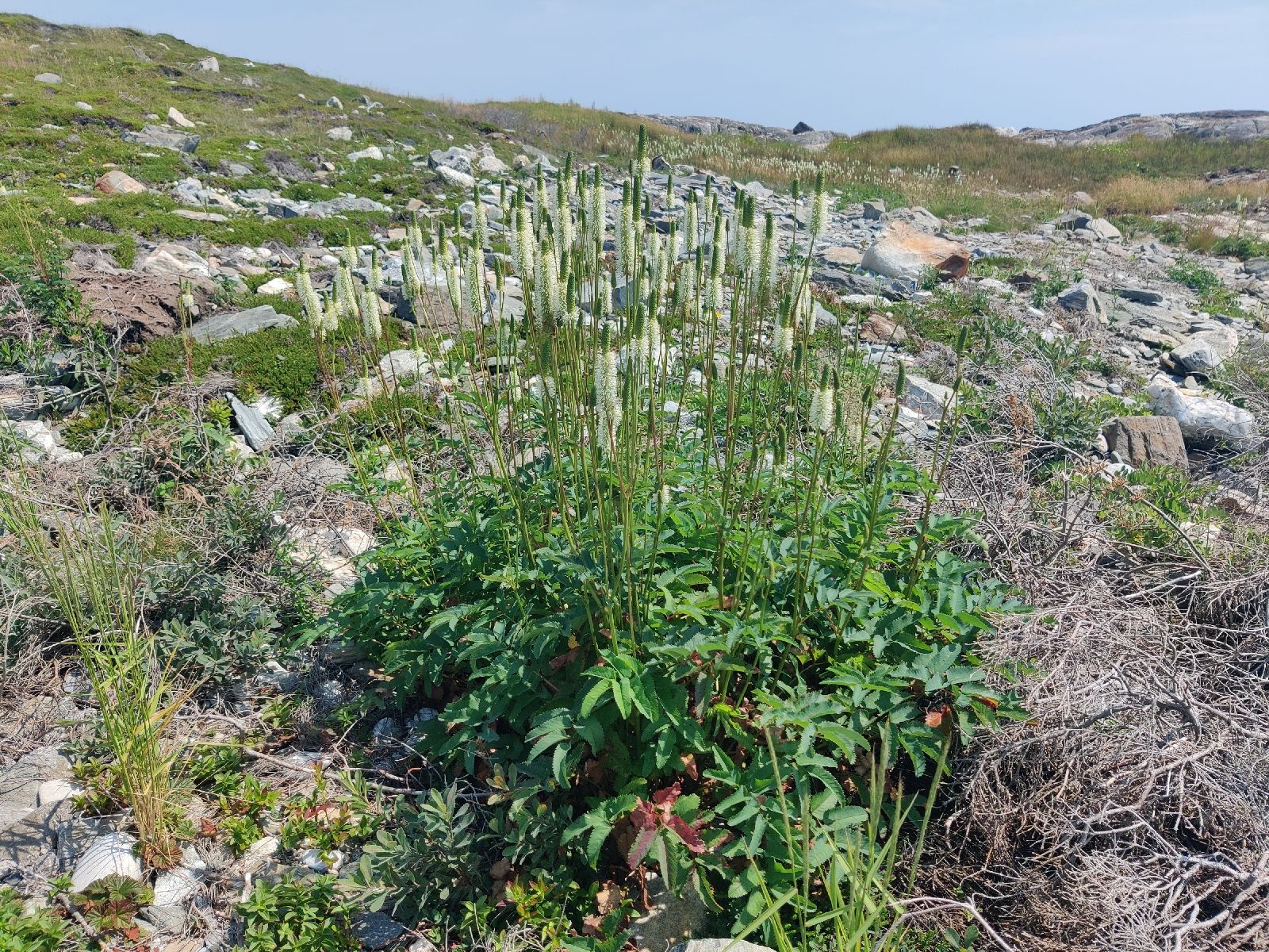
The gentle, but wild landscape seemed to be peatbog over a granite substrate (which often pretrudes through) peppered with water Lilly ponds...

... and is prefuse with wild flowers....


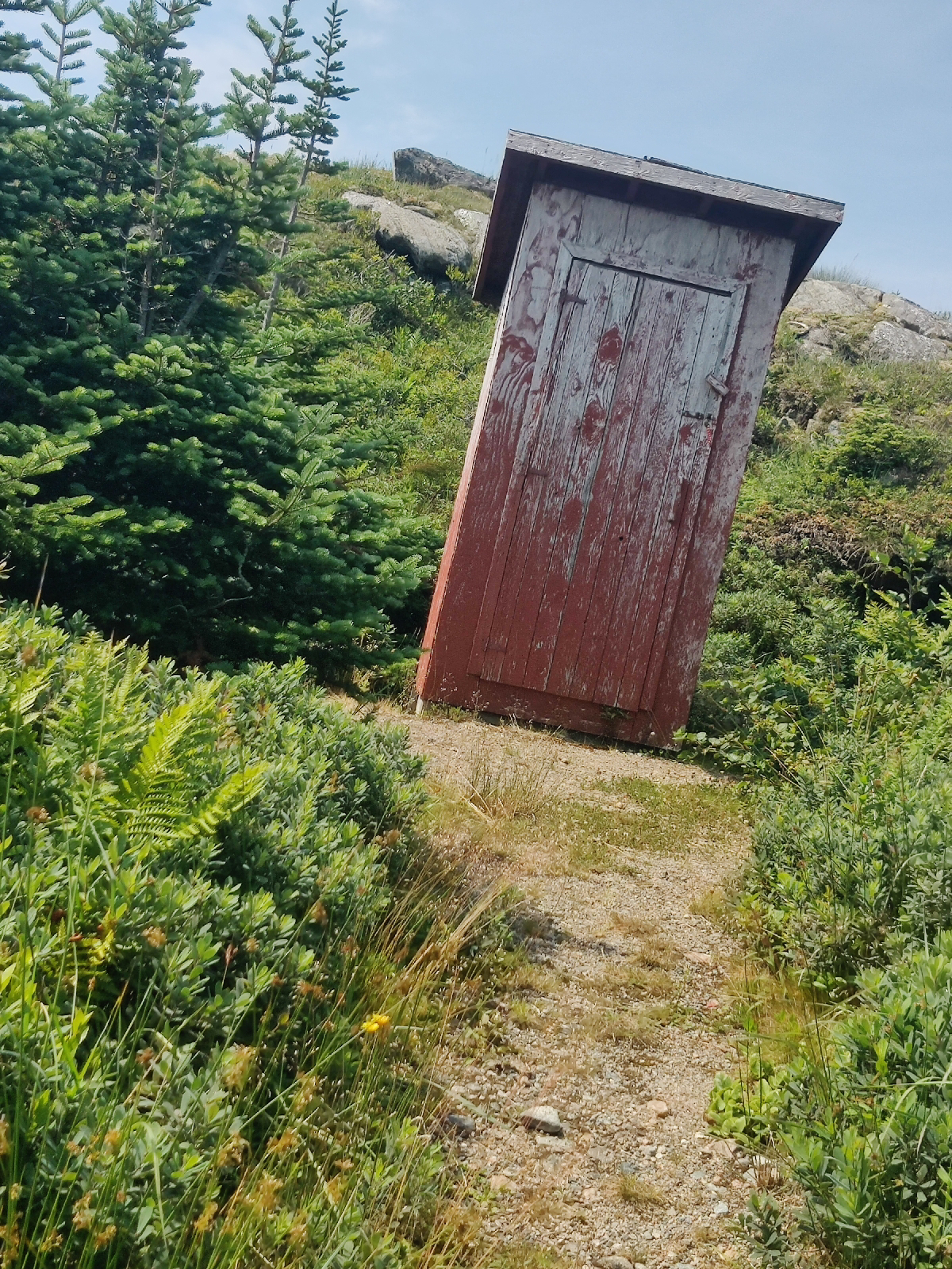
The trail begins with a convenience....

... and  has half a dozen signs erected along its route telling the story of the Harvey family's exploits (it's well worth reading their account in full)....

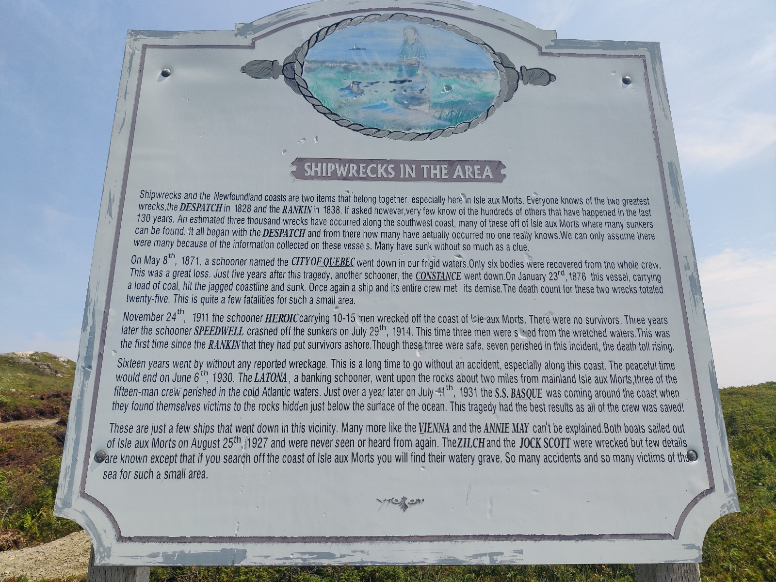
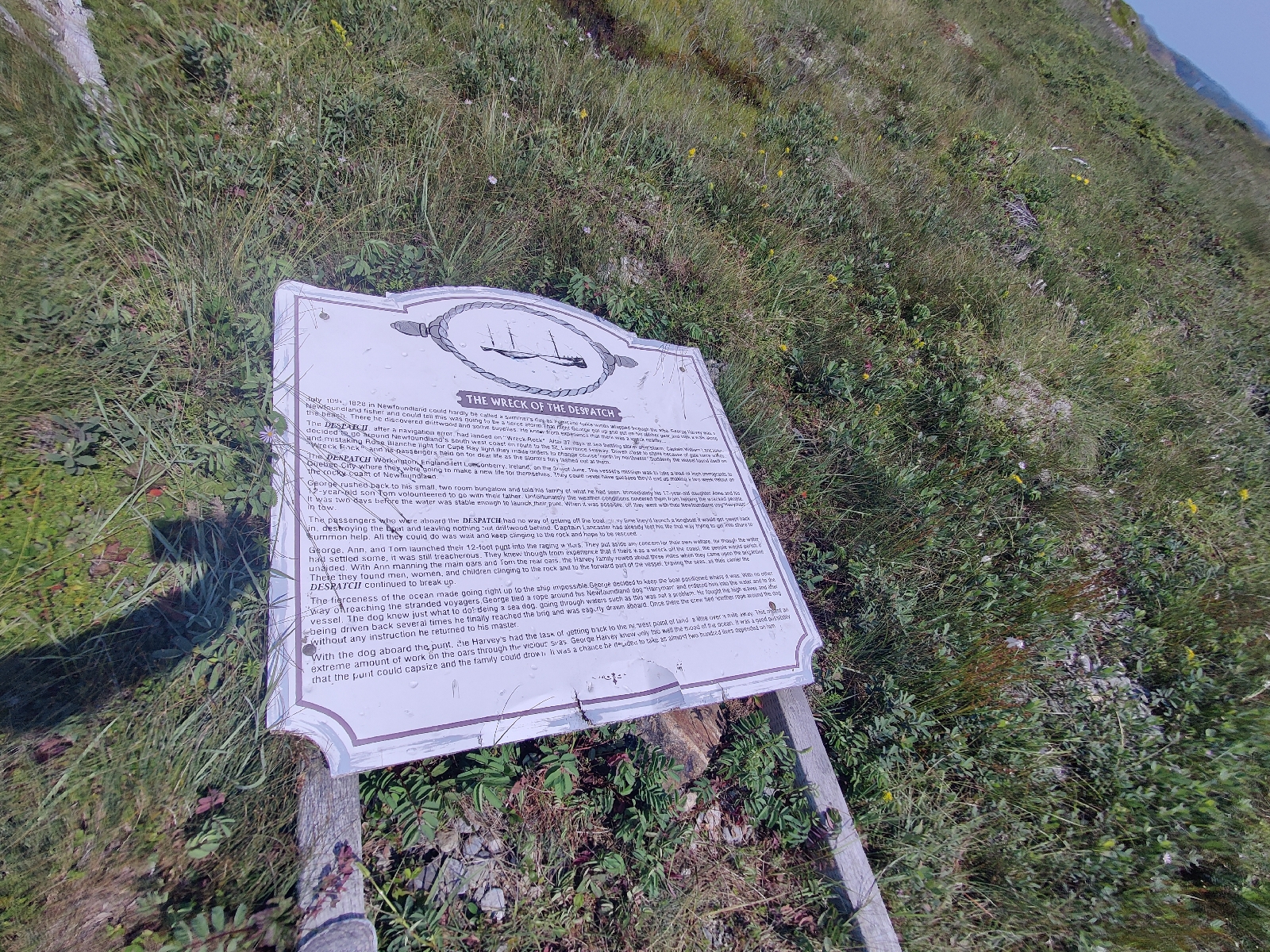
As you can see, some of the signs have fallen victim to the storms that have continued to lash this coast (the most recent being Hurricane Fiona in 2022).

I hadn't fully appreciated that this far north was subject to Hurricane damage, but it clearly is. Fortunately, there is no such weather around at present and St Peter's in Cape Breton, where I will leave the boat is off their normal track

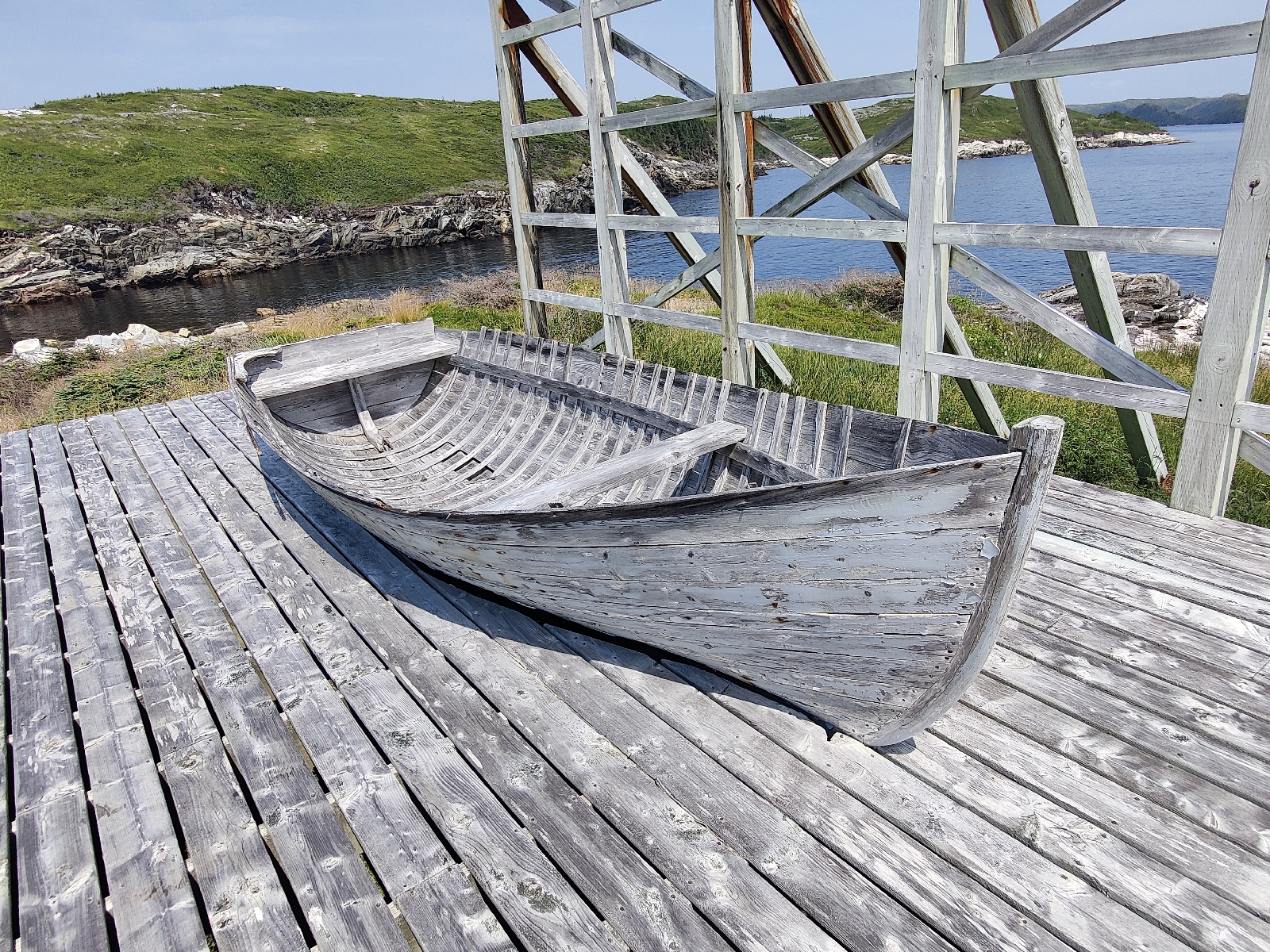
At the end of the trail is a replica of the punt (I have my doubts as to it's accuracey however - it seems much too fragile to have served the purpose described) - the open boat that the Harvey's used on their rescue missions....
I depart for Cape Breton this afternoon.  South Westerlies are forecast for the next 24 hours and should then back to the south. I'll therefore sail as close to south as I can make until the wind veers and then head west. Whether that will take me towards the north east or the south end of Cape Breton, is too early to be sure, but if it's the south, I would probably continue on to the St Peter's canal without stopping, which may make it a two day trip.

Friday 26 July 2024

Hare Bay arrival, exploration and departure

24/7/24

As forecast it is another beautiful day, but with no wind and so we motor the 12 or so miles to the entrance of Hare Bay, which, just like La Hune Bay, is no mere bay, but a fully sculptured fiord.

Somewhat suprisingly as we pass into the fiord, a breeze does spring up from the south and we are able to sail the 6 or so miles up to our destination, Sandy Point, at the head of the fiord.

Once again the scenery is dramatic.  Sheer walls of granite with significant greenery clinging to it rise vertically from the depths on either side of us. I guess the fiord is about 800 metres wide.

As I look back to the entrance, the door seems to slam shut.

My sailing guide describes the anchorage at Sandy Point, as the best on Newfoundland's south coast. In my view, a good anchorage must first and foremost provide shelter, then a straightforward entrance, a grand view, and access to an interesting shore.

Sandy Point is beaten on the last of these, by its fairly close by neighbour, the head of the "Morgan Arm" some 3 miles away. It possesses a rather stunning waterfall cascading down into a pool. It is, according to my guide, possible to anchor in the pool but there are dire warnings of boats "bouncing of rocks" that get it wrong and so I do not intend to risk it. I will though stop off for a look and if it measures ip to its billing, take the dinghy in from Sandy Point tomorrow.

I motor up to the entrance of "the pool" ..

....and am convinced I should come back to explore by dinghy. Then, on to Sandy Point. It's a spit that has developed across the other arm at the head of the fiord and behind it is perfect shelter from the slight chop that otherwise permeates the fiord. 

I'm out of fresh meat and so make a corned beef hash.

The view is pretty good...

Looking north

and looking south.

The closest access to the shore is the otherside of Sandy Point, which is the tree lined spit on the left of the photo above. The "Morgan Arm" is 3 miles further on. 

When I arrive at Sandy Point another boat is there which seems to be deserted. I can see no dinghy in the water or on deck and so I assume the crew are out exploring. I drop anchor a respectful distance away.

I am out of fresh meat and therefore make a half-hearted attempt to fish, with, unsurprisingly, no luck. Dinner is therefore a sort of corned beef hash and will be tomorrow as well!

As night falls I get slightly concerned because there is still no sign of the crew of the other boat. No anchor light appears and I don't detect any sign of life. I start to imagine that the crew had fallen foul of bears or wolves whilst exploring ashore!

I am aware of no more than a gentle lapping of the water on the hull as I drift off to sleep. Such a contrast to the anchorage at Wild Cove.

25/7/24

I get up around 0800 and poke my head outside. To my surprise I see someone moving about on the other boat and realise they are upping an anchor. I wave, but get no response and soon the boat is disappearing around Sandy Point. I decide I have just 'met' my first anti-social Canadian!

I muddle around for the next couple of hours and eventually get the outboard motor on the dinghy and head off to the 'Morgan Arm' with a decent packed lunch. Three miles there and the same back is too far to row and so I disturb the solitude. It's a relief to get there and turn the machine off.

I enter the pool and tie the dinghy to a tree.

The tree is out od shot to the left.

Then I clamber up the side of the fall...

....and look back....

There are enticing pools in which I decide to swim on my way back...

I continue on and walk up the river bed. I guess that rainfall has been fairly light of late because it's fairly dry...

I continue for what I guess is a mile whilst looking for potential trails I could take up the hillside. After a quarter of a mile there's a fork in the river bed. I take the left one. The two channels rejoin later and I return down the other channel.

I see signs of Elk or Mouse 

but not the living creature itself. However, creatures in great abundance are dragonfly. Of course they are too swift for me to capture on camera!

I turn back around at about 1 pm with my thoughts turning to my swim in the pools, followed by lunch!

I'm back at the falls by 2pm and locate the pool I had noticed earlier. I climb down the rocks to a convenient ledge by the water and don my swimming truncks. The likelihood of being 'surprised' by others here, is remote, but ever since Gary and I were caught with our pants down (or rather off) in Bermuda, I have adopted a more cautious approach to wild swimming!

The swimming is delightful - the water not exactly warm but no where near as cold as I expected.

After my swim I dry off on the warm rocks surrounding the pool, have lunch and then a very pleasant siesta. The temperature is just right to soak up the sun without burning and the large rocks make a surprisingly comfortable bed.

After my snooze I gaze around and cannot imagine a more delightful spot for a swim - I feel I am in the company of 'the gods'.

The horizontal slabs of rock on the right partially in the shade, furthest from the camera and against the natural wall, are where I entered the pool, had lunch and my afternoon knap!

Then I go back down the fall to retrieve the dinghy and head back to the boat. I notice another yacht heading up the fiord - it heads for the falls; I'm pretty sure they'll head for Sandy Point later.

I toy with the idea of exploring the beach on the east side of Sandy Point but don't. It's 4pm when I get back to the boat, just enough time for afternoon tea and cake before G&T's in the warm evening sun!

Later, the other boat anchors nearby and I go over to say hello. They're Americans but know this coast well. They're surprised to find anyone else here - the first time apparently! 

Back on Bonny, dinner is yesterday's leftovers of corn beef hash.

26/7/24

My plan was to explore further up the river by dinghy today, but it starts raining after breakfast. I check the weather for the next few days. Apart from the next 24 hours when the winds will be light and variable in direction, fresh south westerlies are forecast for the next week. Reluctantly, I decide I had better head west today and keep going to get as far west as possible so that when the fresh south westerlies arrive I'll have a slightly better angle on the wind for my return to Cape Breton. It will mean motoring for probably 24 hours. Hopefully, I'll be able to put into a convenient port near the west end of the south coast tomorrow evening and rest up before tackling the crossing back to Cape Breton.

It takes me a couple of hours to get ready to leave, including getting the dinghy up on deck. I'm not expecting heavy weather of course, but nevertheless I don't want to tow it overnight just in case.

I get the anchor up at 1.15 pm and motor around Sandy Point and down the fiord towards the open sea.


Wednesday 24 July 2024

Francois (via Wild Cove)

21/7/24

I decided to move round the corner to Wild Cove in the early evening of the 21st. A fresh westerly wind was forecast from midmorning the next day and my guide book says it is well sheltered from wind and swell from that direction where as such wind would put me close to a lee shore in Deadman's Cove.

I wish I'd stayed put and simply left early for Francois. Wild Cove was not sheltered from the swell and we rolled heavily all night. Sleep was hard to come by.

22/7/24

So the next morning around 1100, I get the anchor up (before any sustained wind arrived) and motor the 7 or so miles to Francois.

I moor in front of Nashwana on the floating dock with help from David and Ingar and an American couple Joe and Jane on their motor cruiser moored on the other side of the dock.

The picturess town is perched just above the water at the bottom of steep cliffs and is bisected by a waterfall.

After straightening things out I have a snooze and then go for a walk around town..

Except that the hills look so alluring that I keep going! The local footpaths are covered with boardwalks which, in some cases, seem to go on for ever up the steep mountain sides.
After 30 minutes or so I come across the other two crews descending one of the mountain trails. They are so enthusiastic about the amazing views that despite being unprepared for a long hike (no water or food) I decide to go look for myself.

Some of the "Friar Trail"..

...was quite a scramble but eventually I make it up to the sumit above the town. The views are quite breathtaking with bold glacial bowls and valleys in every direction.


I explore further along the ridge above the bay in which Francois is nestled and soak up the majesty and wildness of it all. I'm not surprised that Paul Trammell felt he had sailed to a mythical land inhabited by dragons and wizards, but I see neither. What strikes me most forcibly, here and in subsequent fiords, is the incredible natural forces that must have created this landscape.

Undoubtedly, the land must once have been scoured by glaciers. The tell-tale U shaped valleys and vast sculptured bowls at their heads along with boulders strewn everywhere, are evidence of that. However, even before the glaciers, huge rock forming and lifting and depressing forces must have been at work to provide the fabric through which the glaciers subsequently scoured. It must have been a truly awesome time. I notice a subtle difference in the rocks here, compared with those at La Hune Bay. There, the granite was pink in colour here it is grey. But then I come across a giant slab of the stuff that seems to have been hit by an enormous force. Its surface was smashed, cracked and splintered, which revealed the same pinkish hue I found at La Hune. It must be something to do with the weathering, but why it should be produce such a different result only a few miles away, I cannot fathom.

Eventually, I check the time, it is past 6pm. I'd better start getting down.

I do so more quickly than I got up and find that Joe has been keeping an eye out for me to to make sure I get down in one piece. Most considerate! 

The sun is still out and it's still warm and so I have enough time to sink a couple of G&Ts in the cockpit before cooking dinner - the last fresh meat I have on board. Pork Cutlets in a curry sauce on a bed of rice. Not bad! 

22/7/24

Its sunny and warm again. Ideal for more hiking. There's a trail that goes up and over the cliffs on the west side of the bay and another that goes up towards the topmost waterfall at the head of the valley above the town. I resolve to try them both.

This time I pack food and drink and swimming trunks and a towel - I rather fancy bathing in the waterfall!

The hike up to the cliffs overlooking the l the fiord from the west starts at the lake that feeds the waterfall that bisects the town, which itself is fed by the waterfall I hope to reach later.

It starts with a steep boardwalk. 
Yet again the views (from a conveniently placed bench) are sublime...

To the north...


and to the south...
And just in case visitors were not sure what was what, a signpost tells all ...

I dally for 20 minutes or so and then head down again, then around the lake and head up the hill towards the top waterfall. I'm not sure if there is a proper trail, but there is.

Sometimes, scrambling using both hands and feet is required but it's not too bad. Then I lose the trail and have to scramble rather more but the waterfall beckons me on..

Finally, I'm there. I check out the source just over the ridge, another lake...

Then I back to the fall for that bath - just there...
It's rather colder than the fall at Deadman's Cove and so I don't linger so long, but it's wonderful nonetheless!

Then lunch followed by a doze spreadout on the warm rocks. Heaven!

After lunch I head down and find the trail that I lost on the way up. It makes for a much easier descent.

On the way down I stop off at the general store and pay for another night (about £8 and for 20 Litres of diesel (about £10)  which the store owners grandson Christian, will sort out for me! The store is run by Sharon by the way...
I get back to the boat by about 3 pm (and notice Vashwana leaving), just as Joe and Jane are preparing to undertake the first part of the hike. Their day has been delayed by news of Joe's mum being taken to hospital, but thankfully she seems to be OK.

Tomorrow I'll head for Sandy Point at the top of Hare Bay, about 20 miles east of Francois.

24/7/24

After breakfast of porridge I head to the general store to buy a few provisions. Back at the boat, I fill up with water and head out of the bay.